Map Search
Map Search is a way of selecting Property or Lease records by making selections from a series of maps. Cityscope maps use a drill down approach. From the top-level Key Map the user is able to zoom in on a particular part of the Cityscope area and ultimately select a property from the map.
If you are searching property data, information about the property will be returned to the View Data screen. Where the selected property is strata subdivided and the "Include/Exclude Strata Units" option (6) is set to "Include Strata Units", records for each individual strata unit will be returned.
If you are searching Leases data, all registered leases for the property selected will be returned to the View Data screen.
When a property is selected using Map Search the returned Property or Lease record(s) are added to any you might already have in your active list.
You can use the "Reset" function on the Main Menu to clear any Property or Lease records in your active list. If you use "Reset" in between each selection you can be sure that the records in your list relate only to the property last selected.
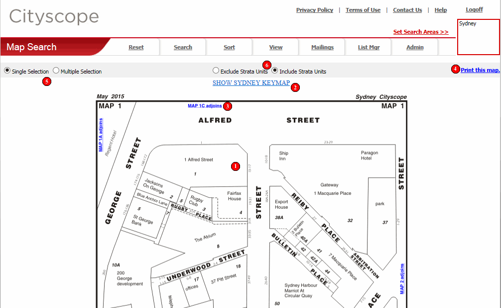
Cityscope Online's Map Search uses a drill down approach. From the top-level Key Map the user is able to zoom in on a particular part of the Cityscope area and ultimately select a property from the map. Clicking anywhere within the property or map's boundary will select it.
At the lowest drill-down level this will result in the Property or Lease record(s) relating to the property selected being returned to the View Data screen.
If there is a further level to drill down, clicking within the boundary will result in the next zoom level being displayed.
To zoom out (or move back up a level) click on the hyperlink which will be visible at both the top and the bottom of the map image.
To move between adjoining maps (at the same drill-down level) click a "Map x adjoins" link.
The map you are currently viewing can be printed by clicking the "Print this map" link. A printable PDF version of the map will display in a separate browser window. To print the map, click the printer icon in the PDF toolbar (as distinct from the printer icon in your browser's toolbar). To return to Cityscope Online, close the browser window displaying the PDF version of the map.
If "Single Selection" is selected when the user clicks a property on the map, they are immediately taken to the View Data screen and presented with the Property or Lease record(s) relating to the property selected.
If "Multiple Selection" is selected when the property is clicked, the Property or Lease record(s) are added to the user's active list but the data is not displayed. Instead the user remains viewing the map, ready for the next property selection. Once all desired properties have been selected the Property or Lease records can be viewed by clicking "View" from the Main Menu.
Some properties are strata subdivided. If "Include Strata Units" is selected (by default it is) and a strata subdivided property is clicked on the map, all Property or Lease record(s) for all strata units in the building are returned.
If "Exclude Strata Units" is selected and a strata subdivided property is clicked on the map, only the head record for the selected property will be returned.
Special Note on Leases
Maps:
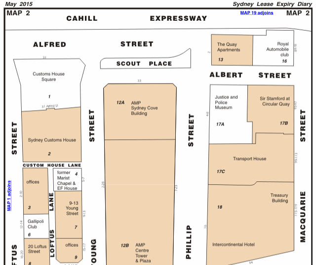
When viewing Lease maps, properties for which registered leases exist are shown
shaded on the map.
Special Note on Unit
Report Maps:
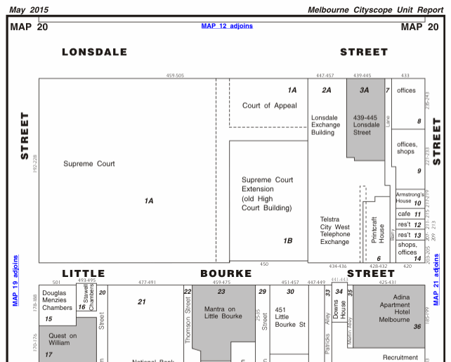
When viewing maps for either the Sydney or Melbourne Residential Unit Report
Cityscopes, the apartment blocks are shown shaded on the maps. Properties that
are not shaded (ie/ not residential) cannot be selected from these maps.